Title:
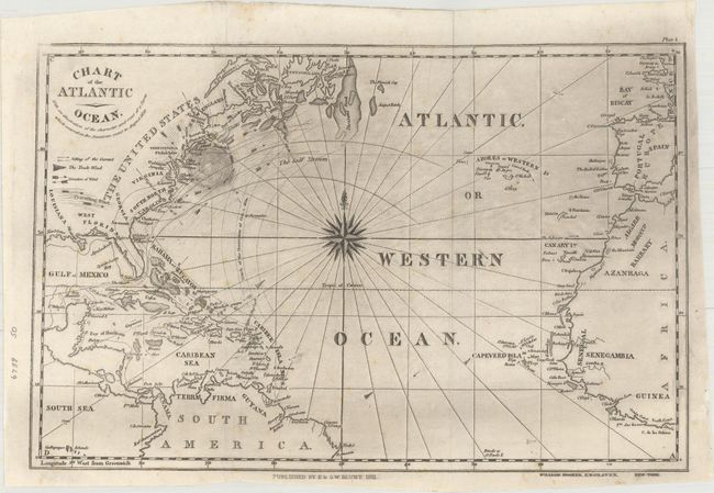
“Chart of the Atlantic Ocean. With an Illustration of the Character and Rout of a Storm Which Occured on the American Coast in August 1830”
Map Maker:
Blunt [Family]
This uncommon chart of the Atlantic Ocean stretche... (full text available to subscribers)
| Item Detail |
| |
| |
MapMaker: |
Blunt [Family]
|
|
| |
| |
Subject: |
North Atlantic |
|
| |
Period/Size: |
1831 / 7.4" x 12.4" (18.8 x 31.5 cm)
|
|
| |
Color: |
Black & White
|
|
| |
Condition: |
(B+) Issued folding with a few faint spots of foxing and minor extraneous creasing adjacent to the left fold. There is light printer's ink residue which is more prominent in the upper half of the image. (condition help) |
|
| |
Source: |
The American Coast Pilot |
|
| |
References: |
|
|
| |
|
|
| Sales Information |
| |
| |
Price: |
|
|
| |
| |
Offered by: |
Old World Auctions |
|
| |
Catalog: |
Auction No. 161 - Antique Maps, Charts, Atlases & Globes (9343) |
|
| |
Lot/Item #: |
483 |
|
| |
| |
Date: |
02/2017
|
|
| |
| |
|
Antique Maps - Valuation and Pricing, Descriptions, Resources |
|
Home |
Information |
Search |
Register |
Contact Us |
Site Map
Americana Exchange, Inc. © 1999 - 2024 Americana Exchange, Inc.. All rights reserved.
OldMaps.com, the OldMaps.com logo and
AMPR are service marks or registered service marks of Americana Exchange, Inc..
|