Title:
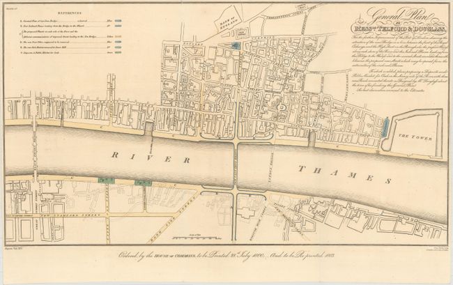
“General Plan by Messrs. Telford & Douglass, for the Further Improvement of the Port of London...”
Map Maker:
James Basire, I
At the end of the 18th century the Port of London ... (full text available to subscribers)
| Item Detail |
| |
| |
MapMaker: |
James Basire, I
|
|
| |
| |
Subject: |
London, England |
|
| |
Period/Size: |
1803 / 11.1" x 20.2" (28.2 x 51.3 cm)
|
|
| |
Color: |
Colored
|
|
| |
Condition: |
(B+) Issued folding with minor offsetting and a couple short fold separations at top. The top margin has been trimmed close to the neatline. (condition help) |
|
| |
Source: |
Report on Providing Accomodation for the Trade and Shipping of the Port of Londo |
|
| |
References: |
|
|
| |
|
|
| Sales Information |
| |
| |
Price: |
|
|
| |
| |
Offered by: |
Old World Auctions |
|
| |
Catalog: |
Auction No. 161 - Antique Maps, Charts, Atlases & Globes (9343) |
|
| |
Lot/Item #: |
507 |
|
| |
| |
Date: |
02/2017
|
|
| |
| |
|
Antique Maps - Valuation and Pricing, Descriptions, Resources |
|
Home |
Information |
Search |
Register |
Contact Us |
Site Map
Americana Exchange, Inc. © 1999 - 2024 Americana Exchange, Inc.. All rights reserved.
OldMaps.com, the OldMaps.com logo and
AMPR are service marks or registered service marks of Americana Exchange, Inc..
|