Title:
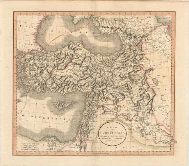
“A New Map of Turkey in Asia, Divided into Its Provinces, from the Best Authorities”
Map Maker:
John Cary
This sharply engraved map is based on the work of ... (full text available to subscribers)
| Item Detail |
| |
| |
MapMaker: |
John Cary
|
|
| |
| |
Subject: |
Near & Middle East |
|
| |
Period/Size: |
1801 / 18.2" x 20.8" (46.3 x 52.9 cm)
|
|
| |
Color: |
Colored
|
|
| |
Condition: |
(B+) Original color on paper watermarked "180" (the last digit being cut off at the edge of the sheet). There is light offsetting and minor soiling. (condition help) |
|
| |
Source: |
New Universal Atlas... |
|
| |
References: |
|
|
| |
|
|
| Sales Information |
| |
| |
Price: |
|
|
| |
| |
Offered by: |
Old World Auctions |
|
| |
Catalog: |
Auction No. 161 - Antique Maps, Charts, Atlases & Globes (9343) |
|
| |
Lot/Item #: |
646 |
|
| |
| |
Date: |
02/2017
|
|
| |
| |
|
Antique Maps - Valuation and Pricing, Descriptions, Resources |
|
Home |
Information |
Search |
Register |
Contact Us |
Site Map
Americana Exchange, Inc. © 1999 - 2024 Americana Exchange, Inc.. All rights reserved.
OldMaps.com, the OldMaps.com logo and
AMPR are service marks or registered service marks of Americana Exchange, Inc..
|