Title:
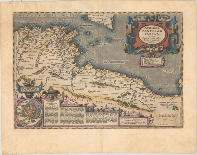
“Africae Propriae Tabula, in qua, Punica Regna Vides; Tyrios, et Agenoris Urbem”
Map Maker:
Abraham Ortelius
Very decorative map of the coastline covering pres... (full text available to subscribers)
| Item Detail |
| |
| |
MapMaker: |
Abraham Ortelius
|
|
| |
| |
Subject: |
Northern Africa |
|
| |
Period/Size: |
1590 / 13.1" x 19.2" (33.3 x 48.8 cm)
|
|
| |
Color: |
Colored
|
|
| |
Condition: |
(B+) A striking impression with full original color on paper with Ortelius' traditional crossed arrows watermark. There is very light toning along the centerfold and faint damp stains in the bottom margin. (condition help) |
|
| |
Source: |
Theatrum Orbis Terrarum |
|
| |
References: |
Van den Broeke #218. |
|
| |
|
|
| Sales Information |
| |
| |
Price: |
|
|
| |
| |
Offered by: |
Old World Auctions |
|
| |
Catalog: |
Auction No. 161 - Antique Maps, Charts, Atlases & Globes (9343) |
|
| |
Lot/Item #: |
720 |
|
| |
| |
Date: |
02/2017
|
|
| |
| |
|
Antique Maps - Valuation and Pricing, Descriptions, Resources |
|
Home |
Information |
Search |
Register |
Contact Us |
Site Map
Americana Exchange, Inc. © 1999 - 2024 Americana Exchange, Inc.. All rights reserved.
OldMaps.com, the OldMaps.com logo and
AMPR are service marks or registered service marks of Americana Exchange, Inc..
|