| Item Detail |
| |
| |
MapMaker: |
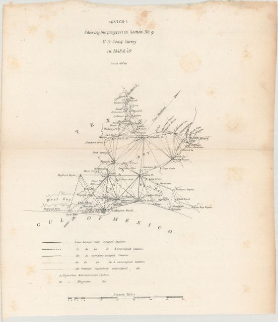
U.S. Coast Survey
|
|
| |
| |
Subject: |
Exploration & Surveys, Texas |
|
| |
Period/Size: |
1849 / 8.7" x 5.5" (22.1 x 14.0 cm)
|
|
| |
Color: |
Black & White
|
|
| |
Condition: |
(B) The maps are overall good to very good with faint toning along the folds and occasional spots of foxing. Two of the maps (Hatteras Inlet and the Florida Keys) have cleanly severed in half with no paper loss. Two other maps are loose, including Galve (condition help) |
|
| |
Source: |
Sen. Ex. Doc. 5, 31st Congress, 1st Session |
|
| |
References: |
cf. Martin & Martin, p. 147. |
|
| |
|
|
| Sales Information |
| |
| |
Price: |
|
|
| |
| |
Offered by: |
Old World Auctions |
|
| |
Catalog: |
Auction No. 161 - Antique Maps, Charts, Atlases & Globes (9343) |
|
| |
Lot/Item #: |
799 |
|
| |
| |
Date: |
02/2017
|
|
| |
| |
|