Title:
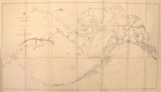
“Report of the Superintendent of the U.S. Coast and Geodetic Survey Showing the Progress of the Work During the Fiscal Year Ending with June, 1894…”
Map Maker:
U.S. Coast & Geodetic Survey
These 2 volumes contain a report of field operatio... (full text available to subscribers)
| Item Detail |
| |
| |
MapMaker: |
U.S. Coast & Geodetic Survey
|
|
| |
| |
Subject: |
Exploration & Surveys, Canada & U.S. |
|
| |
Period/Size: |
1895 / 11.6" x 9.2" (29.5 x 23.4 cm)
|
|
| |
Color: |
Colored
|
|
| |
Condition: |
(A) The folding maps and charts are clean and bright with occasional misfolds and short binding tears. The text has very light, even toning. The covers show minor wear. (condition help) |
|
| |
Source: |
|
|
| |
References: |
|
|
| |
|
|
| Sales Information |
| |
| |
Price: |
|
|
| |
| |
Offered by: |
Old World Auctions |
|
| |
Catalog: |
Auction No. 161 - Antique Maps, Charts, Atlases & Globes (9343) |
|
| |
Lot/Item #: |
801 |
|
| |
| |
Date: |
02/2017
|
|
| |
| |
|
Antique Maps - Valuation and Pricing, Descriptions, Resources |
|
Home |
Information |
Search |
Register |
Contact Us |
Site Map
Americana Exchange, Inc. © 1999 - 2024 Americana Exchange, Inc.. All rights reserved.
OldMaps.com, the OldMaps.com logo and
AMPR are service marks or registered service marks of Americana Exchange, Inc..
|