Title:
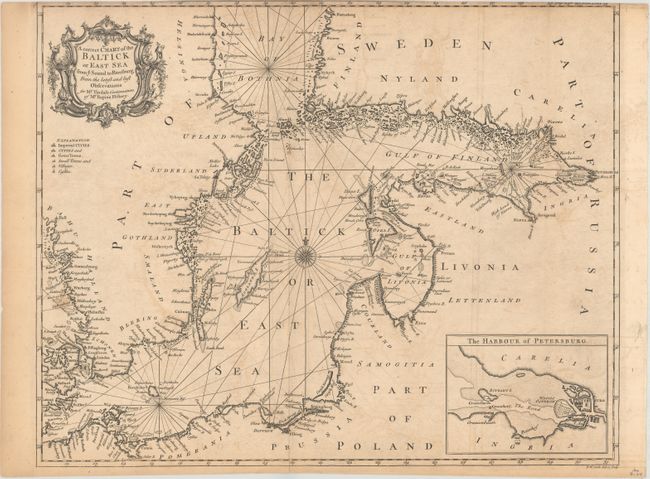
“A Correct Chart of the Baltick or East Sea from ye Sound to Petersburg from the Latest and Best Observations for Mr. Tindal's Continuation of Mr. Rapin's History”
Map Maker:
Richard William Seale
A finely engraved and detailed chart of the Baltic... (full text available to subscribers)
| Item Detail |
| |
| |
MapMaker: |
Richard William Seale
|
|
| |
| |
Subject: |
Baltic |
|
| |
Period/Size: |
1750 / 15.0" x 18.8" (38.1 x 47.8 cm)
|
|
| |
Color: |
Black & White
|
|
| |
Condition: |
(B) Issued folding on watermarked paper with light offsetting and two short fold separations at bottom that just enter the map border. (condition help) |
|
| |
Source: |
Mr. Tindal's Continuation of Mr. Rapin's History |
|
| |
References: |
|
|
| |
|
|
| Sales Information |
| |
| |
Price: |
|
|
| |
| |
Offered by: |
Old World Auctions |
|
| |
Catalog: |
Auction No. 161 - Antique Maps, Charts, Atlases & Globes (9343) |
|
| |
Lot/Item #: |
522 |
|
| |
| |
Date: |
02/2017
|
|
| |
| |
|
Antique Maps - Valuation and Pricing, Descriptions, Resources |
|
Home |
Information |
Search |
Register |
Contact Us |
Site Map
Americana Exchange, Inc. © 1999 - 2024 Americana Exchange, Inc.. All rights reserved.
OldMaps.com, the OldMaps.com logo and
AMPR are service marks or registered service marks of Americana Exchange, Inc..
|