Title:
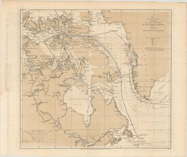
“Chart Illustrating the Remarks of Mr. Findlay, on the Probable Course Pursued by Sir John Franklin's Expedition; and of Captn. Irminger, on the Arctic Current Around Greenland”
Map Maker:
Alexander Findlay
This chart depicts Sir John Franklin's infamous lo... (full text available to subscribers)
| Item Detail |
| |
| |
MapMaker: |
Alexander Findlay
|
|
| |
| |
Subject: |
Northern Canada & Greenland |
|
| |
Period/Size: |
1856 / 12.1" x 13.1" (30.8 x 33.3 cm)
|
|
| |
Color: |
Colored
|
|
| |
Condition: |
(B+) Issued folding and now flattened and backed with tissue. There is light offsetting and a binding trim at lower left that has been replaced with old paper. (condition help) |
|
| |
Source: |
Journal of the Royal Geographical Society |
|
| |
References: |
|
|
| |
|
|
| Sales Information |
| |
| |
Price: |
|
|
| |
| |
Offered by: |
Old World Auctions |
|
| |
Catalog: |
Auction No. 162 - Antique Maps, Charts, Atlases & Globes (9354) |
|
| |
Lot/Item #: |
105 |
|
| |
| |
Date: |
04/2017
|
|
| |
| |
|
Antique Maps - Valuation and Pricing, Descriptions, Resources |
|
Home |
Information |
Search |
Register |
Contact Us |
Site Map
Americana Exchange, Inc. © 1999 - 2024 Americana Exchange, Inc.. All rights reserved.
OldMaps.com, the OldMaps.com logo and
AMPR are service marks or registered service marks of Americana Exchange, Inc..
|