| Item Detail |
| |
| |
MapMaker: |
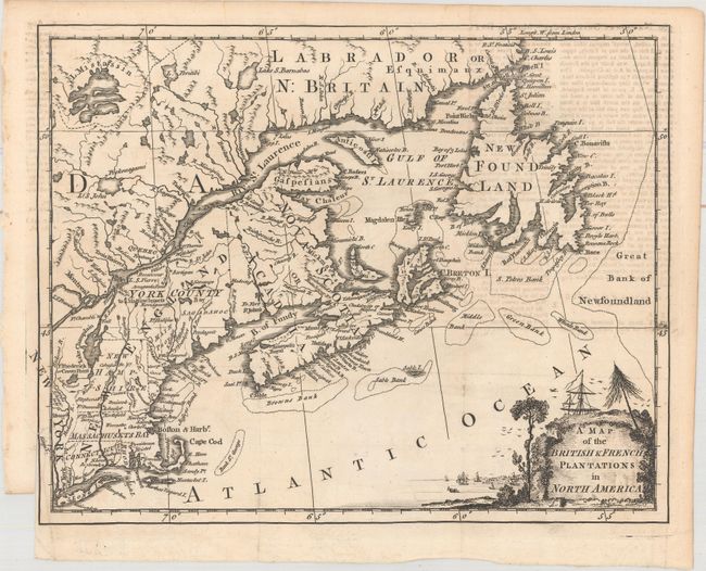
Anonymous
|
|
| |
| |
Subject: |
Colonial United States & Canada |
|
| |
Period/Size: |
1755 / 8.3" x 10.4" (21.1 x 26.5 cm)
|
|
| |
Color: |
Black & White
|
|
| |
Condition: |
(B+) Issued folding with light text show-through and a short binding tear at left that just passes the neatline. (condition help) |
|
| |
Source: |
London Magazine |
|
| |
References: |
Jolly #LOND-96; Kershaw #351; McCorkle #755-28; Sellers & Van Ee #65. |
|
| |
|
|
| Sales Information |
| |
| |
Price: |
|
|
| |
| |
Offered by: |
Old World Auctions |
|
| |
Catalog: |
Auction No. 162 - Antique Maps, Charts, Atlases & Globes (9354) |
|
| |
Lot/Item #: |
111 |
|
| |
| |
Date: |
04/2017
|
|
| |
| |
|