| Item Detail |
| |
| |
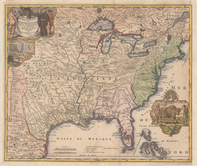
MapMaker: |
Johann Baptist Homann
|
|
| |
| |
Subject: |
Colonial Eastern United States & Canada |
|
| |
Period/Size: |
1720 / 19.1" x 22.8" (48.6 x 58.0 cm)
|
|
| |
Color: |
Colored
|
|
| |
Condition: |
(B+) A nice impression with some light stains at right and bottom, minor soiling, and a couple short printer's creases at bottom left that are reinforced with old paper on verso. The sheet has been remargined at right with old paper and paper tape. Ther (condition help) |
|
| |
Source: |
|
|
| |
References: |
McCorkle #720.1; Goss (NA) #49; cf. Wheat (TMW) #144; cf. Cumming (SE) #170. |
|
| |
|
|
| Sales Information |
| |
| |
Price: |
|
|
| |
| |
Offered by: |
Old World Auctions |
|
| |
Catalog: |
Auction No. 162 - Antique Maps, Charts, Atlases & Globes (9354) |
|
| |
Lot/Item #: |
118 |
|
| |
| |
Date: |
04/2017
|
|
| |
| |
|