Title:
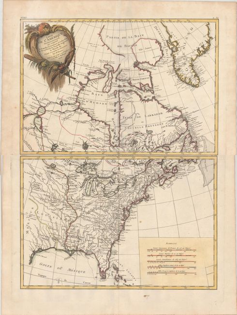
“Partie de l'Amerique Septentrionale, qui Comprend le Canada, la Louisiane, le Labrador, le Groenland, la Nouvelle Angleterre, la Floride &c. Projettee et Assujettie aux Observations”
Map Maker:
Bonne/Lattre
This is the first state of this finely engraved pa... (full text available to subscribers)
| Item Detail |
| |
| |
MapMaker: |
Bonne/Lattre
|
|
| |
| |
Subject: |
Colonial Eastern United States & Canada |
|
| |
Period/Size: |
1771 / 11.8" x 17.1" (30.0 x 43.5 cm)
|
|
| |
Color: |
Colored
|
|
| |
Condition: |
(B+) Crisp impressions on sheets of watermarked paper. The top sheet has minor color offsetting along the centerfold and the lower sheet has one small spot off the coast of Virginia. Minor soiling in the blank margins. (condition help) |
|
| |
Source: |
Atlas Moderne... |
|
| |
References: |
Kershaw #473; McCorkle #771.2. |
|
| |
|
|
| Sales Information |
| |
| |
Price: |
|
|
| |
| |
Offered by: |
Old World Auctions |
|
| |
Catalog: |
Auction No. 162 - Antique Maps, Charts, Atlases & Globes (9354) |
|
| |
Lot/Item #: |
121 |
|
| |
| |
Date: |
04/2017
|
|
| |
| |
|
Antique Maps - Valuation and Pricing, Descriptions, Resources |
|
Home |
Information |
Search |
Register |
Contact Us |
Site Map
Americana Exchange, Inc. © 1999 - 2024 Americana Exchange, Inc.. All rights reserved.
OldMaps.com, the OldMaps.com logo and
AMPR are service marks or registered service marks of Americana Exchange, Inc..
|