| Item Detail |
| |
| |
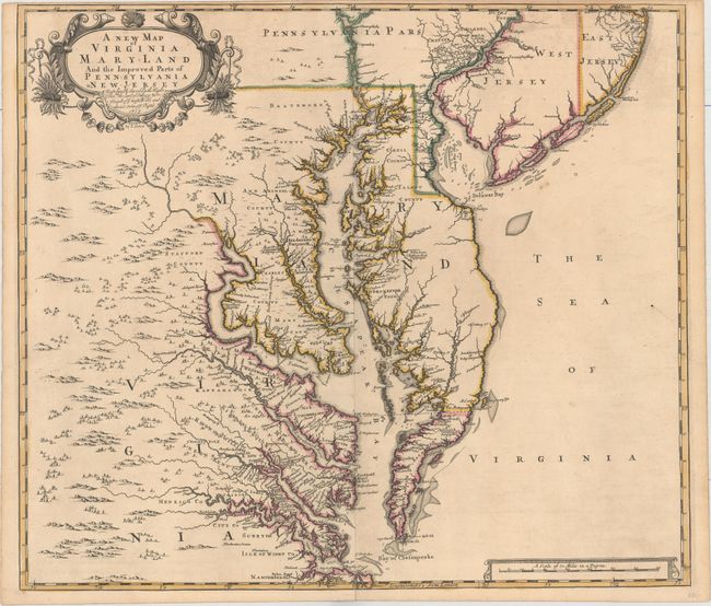
MapMaker: |
Browne/Senex
|
|
| |
| |
Subject: |
Colonial Mid-Atlantic United States |
|
| |
Period/Size: |
1719 / 19.1" x 21.9" (48.6 x 55.7 cm)
|
|
| |
Color: |
Colored
|
|
| |
Condition: |
(A) A superb impression on watermarked paper with a few faint spots and minor toning along the edges of the sheet. There are very short centerfold separations at top and bottom that have been archivally repaired. Narrow top margin, as issued. (condition help) |
|
| |
Source: |
New General Atlas |
|
| |
References: |
Burden #694; Stephenson & McKee, p. 52, #II-17; Stevens & Tree #86c; Wooldridge #84. |
|
| |
|
|
| Sales Information |
| |
| |
Price: |
|
|
| |
| |
Offered by: |
Old World Auctions |
|
| |
Catalog: |
Auction No. 162 - Antique Maps, Charts, Atlases & Globes (9354) |
|
| |
Lot/Item #: |
173 |
|
| |
| |
Date: |
04/2017
|
|
| |
| |
|