| Item Detail |
| |
| |
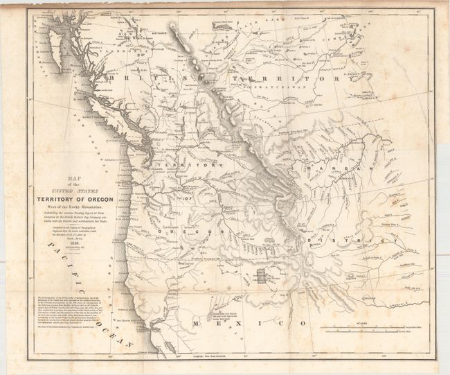
MapMaker: |
Albert/Hood
|
|
| |
| |
Subject: |
Northwestern United States |
|
| |
Period/Size: |
1838 / 17.3" x 20.1" (44.0 x 51.1 cm)
|
|
| |
Color: |
Black & White
|
|
| |
Condition: |
(B) Issued folding with light scattered foxing and toning in the top blank margin. There is a binding trim at right and an associated 4.5" binding tear that has been closed on verso with archival material. (condition help) |
|
| |
Source: |
Monthly Chronicle |
|
| |
References: |
cf. Wheat (TMW) #434; cf. Claussen & Friis #221. |
|
| |
|
|
| Sales Information |
| |
| |
Price: |
|
|
| |
| |
Offered by: |
Old World Auctions |
|
| |
Catalog: |
Auction No. 162 - Antique Maps, Charts, Atlases & Globes (9354) |
|
| |
Lot/Item #: |
222 |
|
| |
| |
Date: |
04/2017
|
|
| |
| |
|