| Item Detail |
| |
| |
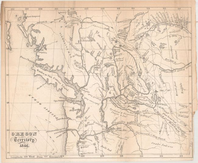
MapMaker: |
Pierre-Jean De Smet
|
|
| |
| |
Subject: |
Books with maps, Northwestern United States |
|
| |
Period/Size: |
1847 / 8.3" x 10.1" (21.1 x 25.7 cm)
|
|
| |
Color: |
Black & White
|
|
| |
Condition: |
(B+) The map has light toning along the folds and sheet edges, and a short binding tear at right that has been archivally repaired on verso. Plates are clean, bright, and near fine while the text is lightly toned. The spine is chipped at top and bottom (condition help) |
|
| |
Source: |
|
|
| |
References: |
Wagner & Camp #141:1; Wheat (TMW) #535. |
|
| |
|
|
| Sales Information |
| |
| |
Price: |
|
|
| |
| |
Offered by: |
Old World Auctions |
|
| |
Catalog: |
Auction No. 162 - Antique Maps, Charts, Atlases & Globes (9354) |
|
| |
Lot/Item #: |
223 |
|
| |
| |
Date: |
04/2017
|
|
| |
| |
|