| Item Detail |
| |
| |
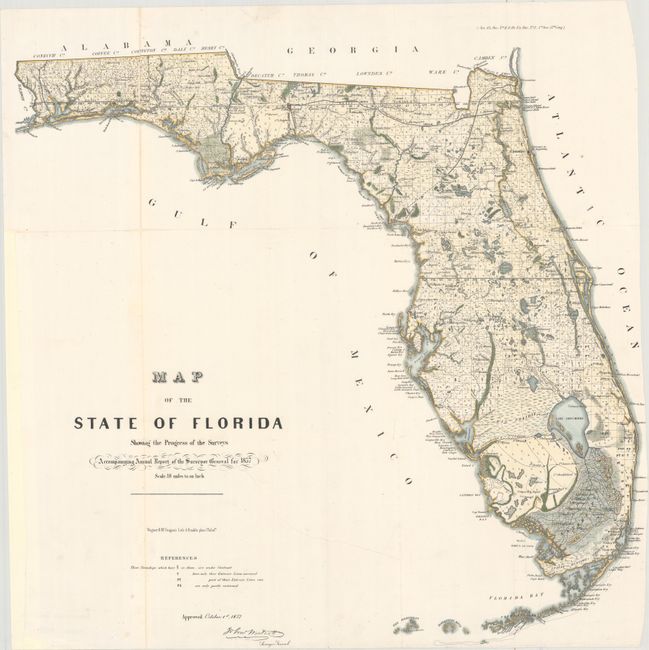
MapMaker: |
U.S. State Surveys
|
|
| |
| |
Subject: |
Florida |
|
| |
Period/Size: |
1857 / 22.9" x 23.9" (58.2 x 60.7 cm)
|
|
| |
Color: |
Colored
|
|
| |
Condition: |
(B+) A very clean and bright example, issued folding, now flattened and backed in thin archival tissue to repair an 8" tear that extends into the title and separations along the folds, with minor loss of image in the far panhandle. The right margin is tr (condition help) |
|
| |
Source: |
Senate Doc. No. 11 & HR Doc. No. 2, 35th Congress, 1st Session |
|
| |
References: |
|
|
| |
|
|
| Sales Information |
| |
| |
Price: |
|
|
| |
| |
Offered by: |
Old World Auctions |
|
| |
Catalog: |
Auction No. 162 - Antique Maps, Charts, Atlases & Globes (9354) |
|
| |
Lot/Item #: |
246 |
|
| |
| |
Date: |
04/2017
|
|
| |
| |
|