| Item Detail |
| |
| |
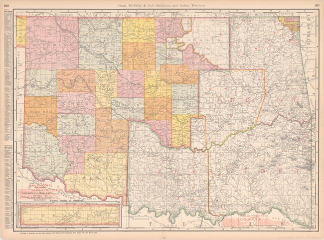
MapMaker: |
Rand, McNally & Co.
|
|
| |
| |
Subject: |
Oklahoma |
|
| |
Period/Size: |
1903 / 19.0" x 25.9" (48.3 x 65.8 cm)
|
|
| |
Color: |
Colored
|
|
| |
Condition: |
(A) There are some minor stains, light toning, and short edge tears and centerfold separations, all confined to the margins with the exception of one edge tear that just enters the neatline at right. (condition help) |
|
| |
Source: |
|
|
| |
References: |
|
|
| |
|
|
| Sales Information |
| |
| |
Price: |
|
|
| |
| |
Offered by: |
Old World Auctions |
|
| |
Catalog: |
Auction No. 162 - Antique Maps, Charts, Atlases & Globes (9354) |
|
| |
Lot/Item #: |
289 |
|
| |
| |
Date: |
04/2017
|
|
| |
| |
|