| Item Detail |
| |
| |
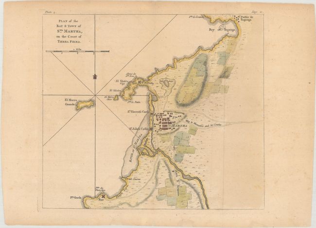
MapMaker: |
Thomas Jefferys
|
|
| |
| |
Subject: |
Santa Marta, Colombia |
|
| |
Period/Size: |
1762 / 8.4" x 9.5" (21.4 x 24.2 cm)
|
|
| |
Color: |
Colored
|
|
| |
Condition: |
(B+) Issued folding with very light toning, a couple of tiny fold separations in blank margins, and thee small chips in bottom blank margin that have been archivally repaired. (condition help) |
|
| |
Source: |
A Description of the Spanish Islands and Settlements ģ West Indies |
|
| |
References: |
Shirley (BL Atlases) M.JEF-3a #4. |
|
| |
|
|
| Sales Information |
| |
| |
Price: |
|
|
| |
| |
Offered by: |
Old World Auctions |
|
| |
Catalog: |
Auction No. 162 - Antique Maps, Charts, Atlases & Globes (9354) |
|
| |
Lot/Item #: |
397 |
|
| |
| |
Date: |
04/2017
|
|
| |
| |
|