Title:
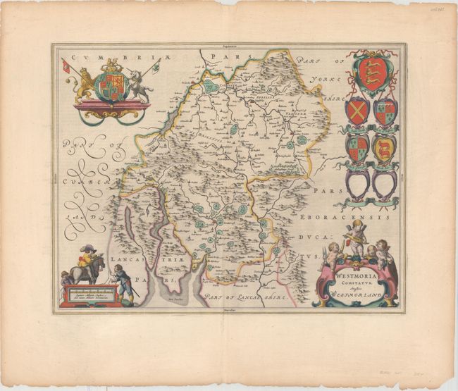
“Westmoria Comitatus; Anglice Westmorland”
Map Maker:
Blaeu [Family]
This attractive map of Westmorland is based on Joh... (full text available to subscribers)
| Item Detail |
| |
| |
MapMaker: |
Blaeu [Family]
|
|
| |
| |
Subject: |
Northern England |
|
| |
Period/Size: |
1648 / 15.0" x 19.6" (38.1 x 49.8 cm)
|
|
| |
Color: |
Colored
|
|
| |
Condition: |
(A) A nice impression with full original color on a watermarked sheet with light printer's ink residue and minor show-through of text on verso. There are a number of short edge tears and light toning confined to the blank margins. (condition help) |
|
| |
Source: |
Toonneel des Aerdrycks ost Nieuwe Atlas... |
|
| |
References: |
Van der Krogt (Vol. II) #5380:2. |
|
| |
|
|
| Sales Information |
| |
| |
Price: |
|
|
| |
| |
Offered by: |
Old World Auctions |
|
| |
Catalog: |
Auction No. 162 - Antique Maps, Charts, Atlases & Globes (9354) |
|
| |
Lot/Item #: |
439 |
|
| |
| |
Date: |
04/2017
|
|
| |
| |
|
Antique Maps - Valuation and Pricing, Descriptions, Resources |
|
Home |
Information |
Search |
Register |
Contact Us |
Site Map
Americana Exchange, Inc. © 1999 - 2024 Americana Exchange, Inc.. All rights reserved.
OldMaps.com, the OldMaps.com logo and
AMPR are service marks or registered service marks of Americana Exchange, Inc..
|