| Item Detail |
| |
| |
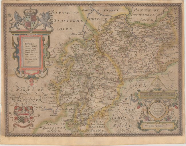
MapMaker: |
Christopher Saxton
|
|
| |
| |
Subject: |
Central England |
|
| |
Period/Size: |
1576 / 15.4" x 20.3" (39.2 x 51.6 cm)
|
|
| |
Color: |
Colored
|
|
| |
Condition: |
(B) Original color with light soiling, two wormholes adjacent to the centerfold, and a few small centerfold separations. Remargined at bottom and the top right corner with a small portion of the border drawn in facsimile. (condition help) |
|
| |
Source: |
[An Atlas of England and Wales] |
|
| |
References: |
Shirley (BL Atlases) T.SAX-1a #22. |
|
| |
|
|
| Sales Information |
| |
| |
Price: |
|
|
| |
| |
Offered by: |
Old World Auctions |
|
| |
Catalog: |
Auction No. 162 - Antique Maps, Charts, Atlases & Globes (9354) |
|
| |
Lot/Item #: |
440 |
|
| |
| |
Date: |
04/2017
|
|
| |
| |
|