Title:
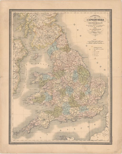
“Carte Particuliere de l'Angleterre et de la Principaute de Galles...”
Map Maker:
Eugene Andriveau-Goujon
This intricately engraved map of England and Wales... (full text available to subscribers)
| Item Detail |
| |
| |
MapMaker: |
Eugene Andriveau-Goujon
|
|
| |
| |
Subject: |
England & Wales |
|
| |
Period/Size: |
1851 / 22.6" x 17.3" (57.4 x 44.0 cm)
|
|
| |
Color: |
Colored
|
|
| |
Condition: |
(B+) Original color on a lightly toned sheet with a few minor spots. An edge tear and centerfold separations in the blank margins have been repaired with old paper on verso. (condition help) |
|
| |
Source: |
Atlas Universel |
|
| |
References: |
|
|
| |
|
|
| Sales Information |
| |
| |
Price: |
|
|
| |
| |
Offered by: |
Old World Auctions |
|
| |
Catalog: |
Auction No. 162 - Antique Maps, Charts, Atlases & Globes (9354) |
|
| |
Lot/Item #: |
446 |
|
| |
| |
Date: |
04/2017
|
|
| |
| |
|
Antique Maps - Valuation and Pricing, Descriptions, Resources |
|
Home |
Information |
Search |
Register |
Contact Us |
Site Map
Americana Exchange, Inc. © 1999 - 2024 Americana Exchange, Inc.. All rights reserved.
OldMaps.com, the OldMaps.com logo and
AMPR are service marks or registered service marks of Americana Exchange, Inc..
|