Title:
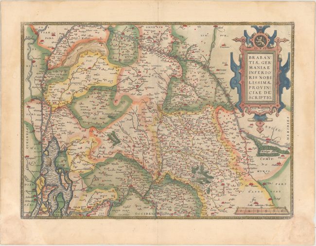
“Brabantiae, Germaniae Inferioris Nobilissimae Provinciae Descriptio”
Map Maker:
Abraham Ortelius
A striking map of Brabant, including Antwerp, as w... (full text available to subscribers)
| Item Detail |
| |
| |
MapMaker: |
Abraham Ortelius
|
|
| |
| |
Subject: |
Low Countries |
|
| |
Period/Size: |
1573 / 14.4" x 19.8" (36.6 x 50.3 cm)
|
|
| |
Color: |
Colored
|
|
| |
Condition: |
(A) Full original color on paper with the crossed arrows watermark commonly found in Ortelius' atlases. There are damp stains that extend along the sides of the sheet, barely entering the borders at the corners, and causing some paper weakness in the bot (condition help) |
|
| |
Source: |
Theatrum Orbis Terrarum |
|
| |
References: |
Van den Broecke #65. |
|
| |
|
|
| Sales Information |
| |
| |
Price: |
|
|
| |
| |
Offered by: |
Old World Auctions |
|
| |
Catalog: |
Auction No. 162 - Antique Maps, Charts, Atlases & Globes (9354) |
|
| |
Lot/Item #: |
473 |
|
| |
| |
Date: |
04/2017
|
|
| |
| |
|
Antique Maps - Valuation and Pricing, Descriptions, Resources |
|
Home |
Information |
Search |
Register |
Contact Us |
Site Map
Americana Exchange, Inc. © 1999 - 2024 Americana Exchange, Inc.. All rights reserved.
OldMaps.com, the OldMaps.com logo and
AMPR are service marks or registered service marks of Americana Exchange, Inc..
|