Title:
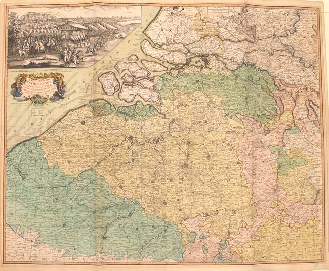
“A New Map of the Netherlands or Low Countries, with the South Part of the Provinces of Holland, Utrecht, & Gelders and the Whole of Zeeland”
Map Maker:
Laurie & Whittle
This incredibly detailed map of the Low Countries ... (full text available to subscribers)
| Item Detail |
| |
| |
MapMaker: |
Laurie & Whittle
|
|
| |
| |
Subject: |
Low Countries |
|
| |
Period/Size: |
1794 / 37.1" x 45.7" (94.3 x 116.1 cm)
|
|
| |
Color: |
Colored
|
|
| |
Condition: |
(B+) There is light toning, mild offsetting, and a 3" fold separation at top right that has been professionally repaired. A few edge tears along the top border that extend 0.5" to 1.5" have been closed on verso with archival tape. (condition help) |
|
| |
Source: |
|
|
| |
References: |
|
|
| |
|
|
| Sales Information |
| |
| |
Price: |
|
|
| |
| |
Offered by: |
Old World Auctions |
|
| |
Catalog: |
Auction No. 162 - Antique Maps, Charts, Atlases & Globes (9354) |
|
| |
Lot/Item #: |
477 |
|
| |
| |
Date: |
04/2017
|
|
| |
| |
|
Antique Maps - Valuation and Pricing, Descriptions, Resources |
|
Home |
Information |
Search |
Register |
Contact Us |
Site Map
Americana Exchange, Inc. © 1999 - 2024 Americana Exchange, Inc.. All rights reserved.
OldMaps.com, the OldMaps.com logo and
AMPR are service marks or registered service marks of Americana Exchange, Inc..
|