Title:
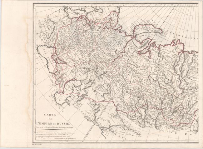
“Carte de l'Empire de Russie, pour Servir a l'Abrege de l'Histoire des Voyages en Europe”
Map Maker:
Pierre Francois Tardieu
This large-scale map, printed on two sheets, cover... (full text available to subscribers)
| Item Detail |
| |
| |
MapMaker: |
Pierre Francois Tardieu
|
|
| |
| |
Subject: |
Russia |
|
| |
Period/Size: |
1801 / 20.8" x 24.0" (52.9 x 61.0 cm)
|
|
| |
Color: |
Colored
|
|
| |
Condition: |
(B+) On watermarked paper with light damp staining along the left and right side of both sheets and some extraneous creasing adjacent to the folds. There is a worm track in the right side of the image of the left sheet and a corresponding worm track in t (condition help) |
|
| |
Source: |
|
|
| |
References: |
|
|
| |
|
|
| Sales Information |
| |
| |
Price: |
|
|
| |
| |
Offered by: |
Old World Auctions |
|
| |
Catalog: |
Auction No. 162 - Antique Maps, Charts, Atlases & Globes (9354) |
|
| |
Lot/Item #: |
551 |
|
| |
| |
Date: |
04/2017
|
|
| |
| |
|
Antique Maps - Valuation and Pricing, Descriptions, Resources |
|
Home |
Information |
Search |
Register |
Contact Us |
Site Map
Americana Exchange, Inc. © 1999 - 2024 Americana Exchange, Inc.. All rights reserved.
OldMaps.com, the OldMaps.com logo and
AMPR are service marks or registered service marks of Americana Exchange, Inc..
|