Title:
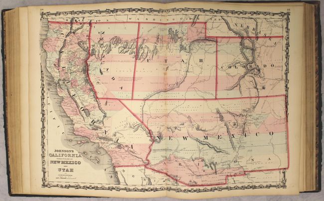
“Johnson's New Illustrated (Steel Plate) Family Atlas, with Descriptions, Geographical, Statistical, and Historical”
Map Maker:
Johnson & Browning
This popular atlas is complete and contains 30 sin... (full text available to subscribers)
| Item Detail |
| |
| |
MapMaker: |
Johnson & Browning
|
|
| |
| |
Subject: |
Atlases |
|
| |
Period/Size: |
1862 / 18.6" x 15.1" (47.3 x 38.4 cm)
|
|
| |
Color: |
Colored
|
|
| |
Condition: |
(B+) Condition code is for the maps, which range in condition from near fine (A) to very good (B+), with light toning, occasional spots of foxing, and minor soiling. There are short centerfold separations (less than 1/2") on 5 maps and larger separations (condition help) |
|
| |
Source: |
|
|
| |
References: |
|
|
| |
|
|
| Sales Information |
| |
| |
Price: |
|
|
| |
| |
Offered by: |
Old World Auctions |
|
| |
Catalog: |
Auction No. 162 - Antique Maps, Charts, Atlases & Globes (9354) |
|
| |
Lot/Item #: |
773 |
|
| |
| |
Date: |
04/2017
|
|
| |
| |
|
Antique Maps - Valuation and Pricing, Descriptions, Resources |
|
Home |
Information |
Search |
Register |
Contact Us |
Site Map
Americana Exchange, Inc. © 1999 - 2024 Americana Exchange, Inc.. All rights reserved.
OldMaps.com, the OldMaps.com logo and
AMPR are service marks or registered service marks of Americana Exchange, Inc..
|