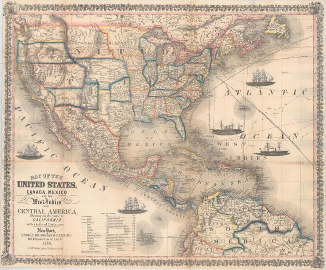
Title:
“Map of the United States, Canada, Mexico and the West Indies with Central America, Showing All the Routes to California with a Table of Distances”
Map Maker:
Ensign, Bridgman & Fanning
This pocket map was published at the end of the Ca... (full text available to subscribers)
| Item Detail |
| |
| |
MapMaker: |
Ensign, Bridgman & Fanning
|
|
| |
| |
Subject: |
North America |
|
| |
Period/Size: |
1854 / 21.7" x 26.0" (55.2 x 66.1 cm)
|
|
| |
Color: |
Colored
|
|
| |
Condition: |
(B+) Issued folding, now flattened and backed in heavy tissue to provide support and repair fold separations and a few minor tears. There are a few very small areas of loss around fold intersections, and light toning along a few folds. (condition help) |
|
| |
Source: |
|
|
| |
References: |
Wheat (TMW) #804. |
|
| |
|
|
| Sales Information |
| |
| |
Price: |
|
|
| |
| |
Offered by: |
Old World Auctions |
|
| |
Catalog: |
Auction No. 163 - Antique Maps, Charts, Atlases & Globes (9365) |
|
| |
Lot/Item #: |
37 |
|
| |
| |
Date: |
06/2017
|
|
| |
| |
|
Antique Maps - Valuation and Pricing, Descriptions, Resources |
|
Home |
Information |
Search |
Register |
Contact Us |
Site Map
Americana Exchange, Inc. © 1999 - 2024 Americana Exchange, Inc.. All rights reserved.
OldMaps.com, the OldMaps.com logo and
AMPR are service marks or registered service marks of Americana Exchange, Inc..
|