| Item Detail |
| |
| |
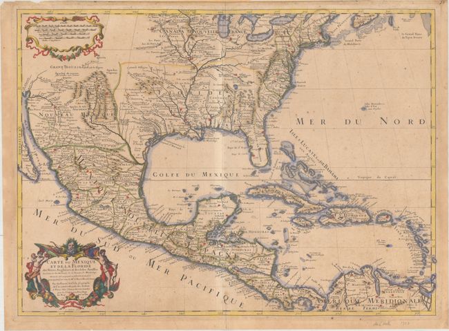
MapMaker: |
Guillaume Delisle
|
|
| |
| |
Subject: |
Colonial Eastern North America & West Indies |
|
| |
Period/Size: |
1703 / 18.7" x 25.6" (47.5 x 65.1 cm)
|
|
| |
Color: |
Colored
|
|
| |
Condition: |
(B+) A sharp impression on watermarked paper with original outline color and later color in the cartouches and long the coastlines. There is light toning, scattered foxing, a printer's crease adjacent to the centerfold at bottom, and an extraneous crease (condition help) |
|
| |
Source: |
|
|
| |
References: |
Cumming (SE) #137; Lemmon plt 16; Tooley (Amer) #48, p. 22; Wheat, pp 58-61; Schwartz & Ehrenberg, |
|
| |
|
|
| Sales Information |
| |
| |
Price: |
|
|
| |
| |
Offered by: |
Old World Auctions |
|
| |
Catalog: |
Auction No. 163 - Antique Maps, Charts, Atlases & Globes (9365) |
|
| |
Lot/Item #: |
40 |
|
| |
| |
Date: |
06/2017
|
|
| |
| |
|