| Item Detail |
| |
| |
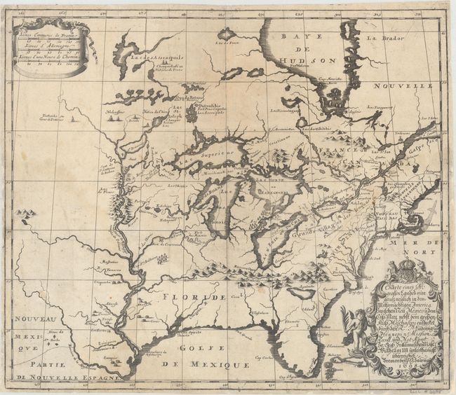
MapMaker: |
Louis de Hennepin
|
|
| |
| |
Subject: |
Colonial Eastern United States & Canada |
|
| |
Period/Size: |
1698 / 14.5" x 16.9" (36.9 x 43.0 cm)
|
|
| |
Color: |
Black & White
|
|
| |
Condition: |
(B) Issued folding on watermarked paper and now flattened and backed with tissue to reinforce and repair numerous small fold separations and tiny edge chips and tears. There are faint damp stains in much of the image, but do not distract. (condition help) |
|
| |
Source: |
|
|
| |
References: |
McCorkle #698.3; cf. Burden #739; cf. Karpinski, pp. 118-123. |
|
| |
|
|
| Sales Information |
| |
| |
Price: |
|
|
| |
| |
Offered by: |
Old World Auctions |
|
| |
Catalog: |
Auction No. 163 - Antique Maps, Charts, Atlases & Globes (9365) |
|
| |
Lot/Item #: |
53 |
|
| |
| |
Date: |
06/2017
|
|
| |
| |
|