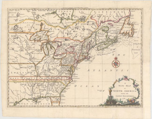
Title:
“A New Map of North America from the Latest Discoveries”
Map Maker:
John Spilsbury
This is the uncommon first state, not the 1763 edi... (full text available to subscribers)
| Item Detail |
| |
| |
MapMaker: |
John Spilsbury
|
|
| |
| |
Subject: |
Colonial Eastern United States & Canada |
|
| |
Period/Size: |
1761 / 10.8" x 14.9" (27.5 x 37.9 cm)
|
|
| |
Color: |
Colored
|
|
| |
Condition: |
(A) Issued folding on watermarked paper with faint offsetting. The binding trim at bottom right has been replaced with old paper, and the adjacent 2" binding tear (half of which is confined to the border) has been professionally repaired. (condition help) |
|
| |
Source: |
The Continuation of Dr. Smollett's History of England |
|
| |
References: |
McCorkle #761.3; Sellers & Van Ee #89. |
|
| |
|
|
| Sales Information |
| |
| |
Price: |
|
|
| |
| |
Offered by: |
Old World Auctions |
|
| |
Catalog: |
Auction No. 163 - Antique Maps, Charts, Atlases & Globes (9365) |
|
| |
Lot/Item #: |
59 |
|
| |
| |
Date: |
06/2017
|
|
| |
| |
|
Antique Maps - Valuation and Pricing, Descriptions, Resources |
|
Home |
Information |
Search |
Register |
Contact Us |
Site Map
Americana Exchange, Inc. © 1999 - 2024 Americana Exchange, Inc.. All rights reserved.
OldMaps.com, the OldMaps.com logo and
AMPR are service marks or registered service marks of Americana Exchange, Inc..
|