| Item Detail |
| |
| |
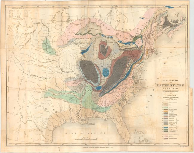
MapMaker: |
Charles Lyell
|
|
| |
| |
Subject: |
Eastern United States & Canada |
|
| |
Period/Size: |
1845 / 15.2" x 19.7" (38.6 x 50.1 cm)
|
|
| |
Color: |
Colored
|
|
| |
Condition: |
(B) Issued folding with a "J. Whatman 1839" watermark, light toning, and moderate offsetting. There are short fold separations and a binding tear that enters the neatline at right, all of which have been closed with archival tape on verso. (condition help) |
|
| |
Source: |
Travels in North America; with Geological Observations... |
|
| |
References: |
Marcou & Marcou #34. |
|
| |
|
|
| Sales Information |
| |
| |
Price: |
|
|
| |
| |
Offered by: |
Old World Auctions |
|
| |
Catalog: |
Auction No. 163 - Antique Maps, Charts, Atlases & Globes (9365) |
|
| |
Lot/Item #: |
68 |
|
| |
| |
Date: |
06/2017
|
|
| |
| |
|