| Item Detail |
| |
| |
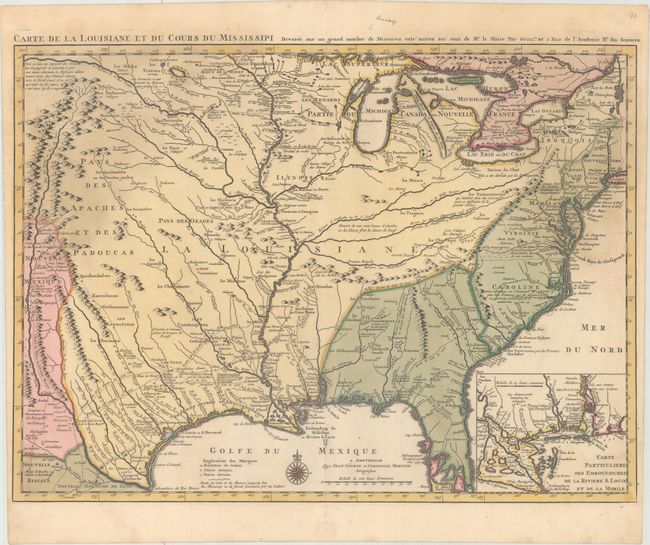
MapMaker: |
Delisle/Covens & Mortier
|
|
| |
| |
Subject: |
Colonial Eastern United States, Louisiana Territory |
|
| |
Period/Size: |
1730 / 17.4" x 23.6" (44.2 x 60.0 cm)
|
|
| |
Color: |
Colored
|
|
| |
Condition: |
(B+) A sharp impression with full original color and light damp stains in the top corners of the map. (condition help) |
|
| |
Source: |
Atlas Nouveau |
|
| |
References: |
Cumming (SE) #208; Tooley (Amer) p.22, #45; cf. Wheat (TMW) #99; cf. Martin & Martin #19. |
|
| |
|
|
| Sales Information |
| |
| |
Price: |
|
|
| |
| |
Offered by: |
Old World Auctions |
|
| |
Catalog: |
Auction No. 163 - Antique Maps, Charts, Atlases & Globes (9365) |
|
| |
Lot/Item #: |
98 |
|
| |
| |
Date: |
06/2017
|
|
| |
| |
|