Title:
“Travels in the United States of America, in the Years 1806 & 1807, and 1809, 1810, & 1811; Including an Account of Passages Betwixt America and Britain…”
Map Maker:
John Melish
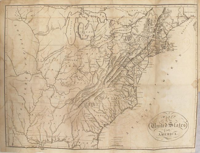
This is the first edition of Melish's Travels i... (full text available to subscribers)
| Item Detail |
| |
| |
MapMaker: |
John Melish
|
|
| |
| |
Subject: |
Exploration, United States |
|
| |
Period/Size: |
1812 / 8.6" x 5.5" (21.9 x 14.0 cm)
|
|
| |
Color: |
Black & White
|
|
| |
Condition: |
(B) All of the maps have light to moderate toning, offsetting, and blind library stamps on verso that are nearly invisible on verso. The large map of the United States has damp stains along the folds and a short repaired binding tear at right. The map o (condition help) |
|
| |
Source: |
|
|
| |
References: |
Howes #M496; Sabin #47436; Streeter Sale #835; cf. Ristow p. 184. |
|
| |
|
|
| Sales Information |
| |
| |
Price: |
|
|
| |
| |
Offered by: |
Old World Auctions |
|
| |
Catalog: |
Auction No. 163 - Antique Maps, Charts, Atlases & Globes (9365) |
|
| |
Lot/Item #: |
109 |
|
| |
| |
Date: |
06/2017
|
|
| |
| |
|
Antique Maps - Valuation and Pricing, Descriptions, Resources |
|
Home |
Information |
Search |
Register |
Contact Us |
Site Map
Americana Exchange, Inc. © 1999 - 2024 Americana Exchange, Inc.. All rights reserved.
OldMaps.com, the OldMaps.com logo and
AMPR are service marks or registered service marks of Americana Exchange, Inc..
|