Title:
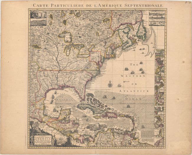
“A Map of the British Empire in America with the French, Spanish and Hollandish Settlements Adjacent Thereto by Henry Popple”
Map Maker:
Popple/Covens & Mortier
This is the index sheet of the Dutch version of He... (full text available to subscribers)
| Item Detail |
| |
| |
MapMaker: |
Popple/Covens & Mortier
|
|
| |
| |
Subject: |
Colonial Eastern North America & West Indies |
|
| |
Period/Size: |
1741 / 19.4" x 19.0" (49.3 x 48.3 cm)
|
|
| |
Color: |
Colored
|
|
| |
Condition: |
(A) Fine original color and impression with very light toning and a few unobtrusive spots of foxing. There is a tiny hole in wide blank margins, well away from map. (condition help) |
|
| |
Source: |
|
|
| |
References: |
Cumming (SE) #231; McCorkle #741.3; cf. Pritchard & Taliaferro #24. |
|
| |
|
|
| Sales Information |
| |
| |
Price: |
|
|
| |
| |
Offered by: |
Old World Auctions |
|
| |
Catalog: |
Auction No. 163 - Antique Maps, Charts, Atlases & Globes (9365) |
|
| |
Lot/Item #: |
41 |
|
| |
| |
Date: |
06/2017
|
|
| |
| |
|
Antique Maps - Valuation and Pricing, Descriptions, Resources |
|
Home |
Information |
Search |
Register |
Contact Us |
Site Map
Americana Exchange, Inc. © 1999 - 2024 Americana Exchange, Inc.. All rights reserved.
OldMaps.com, the OldMaps.com logo and
AMPR are service marks or registered service marks of Americana Exchange, Inc..
|