| Item Detail |
| |
| |
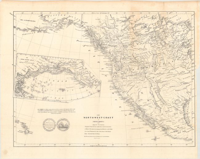
MapMaker: |
David H. Burr
|
|
| |
| |
Subject: |
Western North America |
|
| |
Period/Size: |
1840 / 16.3" x 21.1" (41.4 x 53.6 cm)
|
|
| |
Color: |
Black & White
|
|
| |
Condition: |
(B+) Issued folding with minor toning mostly concentrated in the upper right hand quadrant of the sheet. There is a binding trim at right with an associated tear that just touches the neatline. (condition help) |
|
| |
Source: |
Greenhow's Memoir of the North West Coast |
|
| |
References: |
Phillips (Maps) p. 603; Wheat [TMW] #447. |
|
| |
|
|
| Sales Information |
| |
| |
Price: |
|
|
| |
| |
Offered by: |
Old World Auctions |
|
| |
Catalog: |
Auction No. 163 - Antique Maps, Charts, Atlases & Globes (9365) |
|
| |
Lot/Item #: |
45 |
|
| |
| |
Date: |
06/2017
|
|
| |
| |
|