Title:
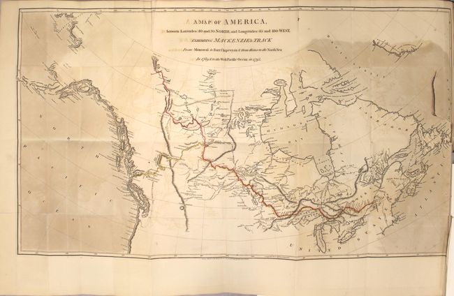
“Voyages from Montreal, on the River St. Laurence, Through the Continent of North America, to the Frozen and Pacific Oceans; in the Years 1789 and 1793...”
Map Maker:
Alexander Mackenzie
This is the first and finest edition of Mackenzie'... (full text available to subscribers)
| Item Detail |
| |
| |
MapMaker: |
Alexander Mackenzie
|
|
| |
| |
Subject: |
Canada |
|
| |
Period/Size: |
1801 / 10.9" x 8.6" (27.7 x 21.9 cm)
|
|
| |
Color: |
Black & White
|
|
| |
Condition: |
(B) The three folding maps have light offsetting, a few tiny splits at fold intersections, and binding tears ranging from 1.5" to 3.5" in size. The Map of America also has uneven toning at left and right. Text has light toning and occasional minor foxin (condition help) |
|
| |
Source: |
|
|
| |
References: |
Wagner-Camp #1:1; Howes #M133; Sabin #43414; Streeter Sale #3653; Wheat (TMW) #251. |
|
| |
|
|
| Sales Information |
| |
| |
Price: |
|
|
| |
| |
Offered by: |
Old World Auctions |
|
| |
Catalog: |
Auction No. 163 - Antique Maps, Charts, Atlases & Globes (9365) |
|
| |
Lot/Item #: |
46 |
|
| |
| |
Date: |
06/2017
|
|
| |
| |
|
Antique Maps - Valuation and Pricing, Descriptions, Resources |
|
Home |
Information |
Search |
Register |
Contact Us |
Site Map
Americana Exchange, Inc. © 1999 - 2024 Americana Exchange, Inc.. All rights reserved.
OldMaps.com, the OldMaps.com logo and
AMPR are service marks or registered service marks of Americana Exchange, Inc..
|