| Item Detail |
| |
| |
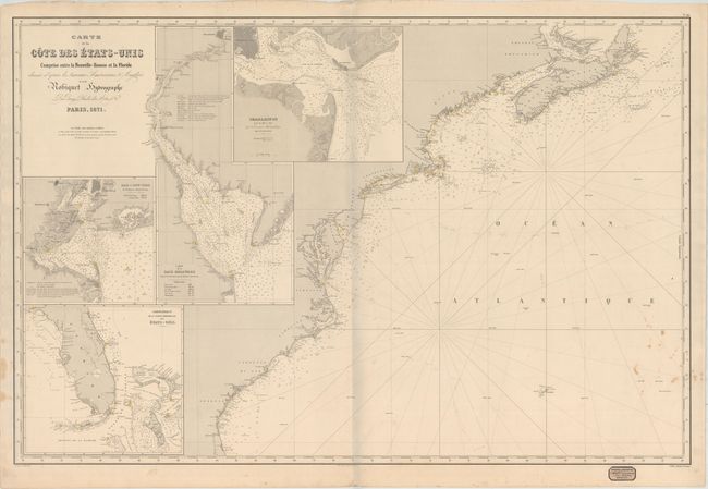
MapMaker: |
Aime Robiquet
|
|
| |
| |
Subject: |
Eastern United States |
|
| |
Period/Size: |
1871 / 26.4" x 39.8" (67.1 x 101.1 cm)
|
|
| |
Color: |
Black & White
|
|
| |
Condition: |
(B+) A nice impression with minor foxing along the lower border at left and right. There are light pencil notations in the Atlantic Ocean and some minor edge tears confined to the top and bottom blank margins. (condition help) |
|
| |
Source: |
|
|
| |
References: |
|
|
| |
|
|
| Sales Information |
| |
| |
Price: |
|
|
| |
| |
Offered by: |
Old World Auctions |
|
| |
Catalog: |
Auction No. 163 - Antique Maps, Charts, Atlases & Globes (9365) |
|
| |
Lot/Item #: |
135 |
|
| |
| |
Date: |
06/2017
|
|
| |
| |
|