| Item Detail |
| |
| |
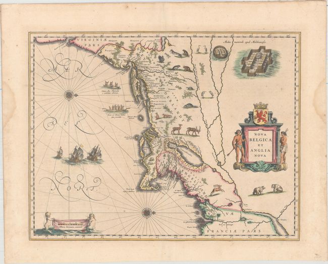
MapMaker: |
Willem Blaeu
|
|
| |
| |
Subject: |
Colonial New England & Mid-Atlantic United States |
|
| |
Period/Size: |
1640 / 15.3" x 19.9" (38.9 x 50.6 cm)
|
|
| |
Color: |
Colored
|
|
| |
Condition: |
(B+) Original color on watermarked paper with minor foxing and faint show through of text on verso. Two damp stains are confined to the left and right blank margins, well away from map. Very nearly in "A" condition. (condition help) |
|
| |
Source: |
|
|
| |
References: |
Burden #241; Goss (Blaeu) p. 164; McCorkle #635.1; Van der Krogt (Vol. II) #9310:2. |
|
| |
|
|
| Sales Information |
| |
| |
Price: |
|
|
| |
| |
Offered by: |
Old World Auctions |
|
| |
Catalog: |
Auction No. 163 - Antique Maps, Charts, Atlases & Globes (9365) |
|
| |
Lot/Item #: |
138 |
|
| |
| |
Date: |
06/2017
|
|
| |
| |
|