Title:
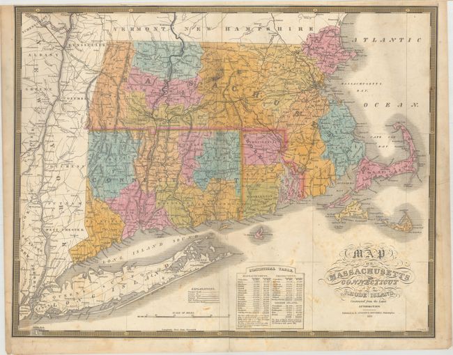
“Map of Massachusetts Connecticut and Rhode Island Constructed from the Latest Authorities”
Map Maker:
Samuel Augustus Mitchell
This map comes from Mitchell's first edition A ... (full text available to subscribers)
| Item Detail |
| |
| |
MapMaker: |
Samuel Augustus Mitchell
|
|
| |
| |
Subject: |
New England United States |
|
| |
Period/Size: |
1831 / 16.9" x 21.5" (43.0 x 54.7 cm)
|
|
| |
Color: |
Colored
|
|
| |
Condition: |
(B) The map has been backed with tissue to reinforce and repair a number of centerfold separations and a few edge tears. An approximate 1" x 6" mostly blank section at the top center of the image has been professionally replaced in facsimile. (condition help) |
|
| |
Source: |
A New American Atlas... |
|
| |
References: |
|
|
| |
|
|
| Sales Information |
| |
| |
Price: |
|
|
| |
| |
Offered by: |
Old World Auctions |
|
| |
Catalog: |
Auction No. 163 - Antique Maps, Charts, Atlases & Globes (9365) |
|
| |
Lot/Item #: |
141 |
|
| |
| |
Date: |
06/2017
|
|
| |
| |
|
Antique Maps - Valuation and Pricing, Descriptions, Resources |
|
Home |
Information |
Search |
Register |
Contact Us |
Site Map
Americana Exchange, Inc. © 1999 - 2024 Americana Exchange, Inc.. All rights reserved.
OldMaps.com, the OldMaps.com logo and
AMPR are service marks or registered service marks of Americana Exchange, Inc..
|