| Item Detail |
| |
| |
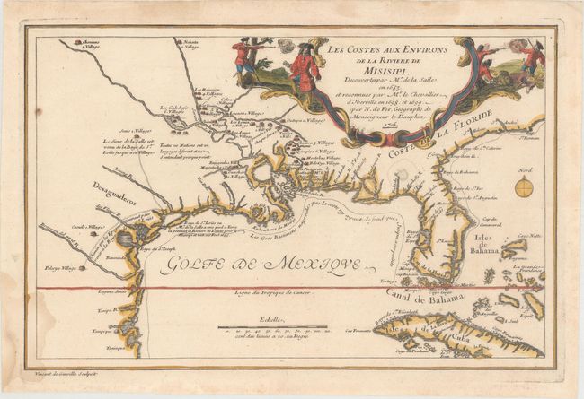
MapMaker: |
Nicolas de Fer
|
|
| |
| |
Subject: |
Colonial Southern United States |
|
| |
Period/Size: |
1705 / 8.6" x 13.2" (21.9 x 33.6 cm)
|
|
| |
Color: |
Colored
|
|
| |
Condition: |
(B+) A crisp impression on watermarked paper with a small rust spot at top left, a damp stain just below the title cartouche, and several damp stains along the edges of the sheet, entering the map image at bottom left. (condition help) |
|
| |
Source: |
L’Atlas Curieux... |
|
| |
References: |
Day #1458; Lemmon, Magill & Wiese #12; Martin & Martin #13; Pastoureau, FER ID. |
|
| |
|
|
| Sales Information |
| |
| |
Price: |
|
|
| |
| |
Offered by: |
Old World Auctions |
|
| |
Catalog: |
Auction No. 163 - Antique Maps, Charts, Atlases & Globes (9365) |
|
| |
Lot/Item #: |
155 |
|
| |
| |
Date: |
06/2017
|
|
| |
| |
|