| Item Detail |
| |
| |
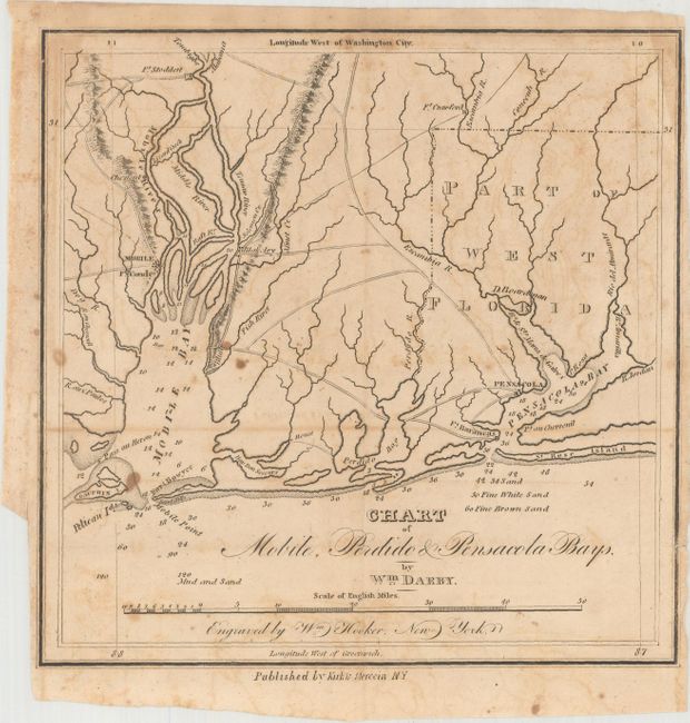
MapMaker: |
William Darby
|
|
| |
| |
Subject: |
Alabama & Florida |
|
| |
Period/Size: |
1818 / 8.1" x 8.1" (20.6 x 20.6 cm)
|
|
| |
Color: |
Black & White
|
|
| |
Condition: |
(B) A nice impression, issued folding, with light offsetting and scattered foxing. A short edge tear along the top left border has been closed on verso with archival tape. (condition help) |
|
| |
Source: |
The Emigrant's Guide |
|
| |
References: |
Phillips (Maps) p. 691; Wagner-Camp #14b. |
|
| |
|
|
| Sales Information |
| |
| |
Price: |
|
|
| |
| |
Offered by: |
Old World Auctions |
|
| |
Catalog: |
Auction No. 163 - Antique Maps, Charts, Atlases & Globes (9365) |
|
| |
Lot/Item #: |
181 |
|
| |
| |
Date: |
06/2017
|
|
| |
| |
|