Title:
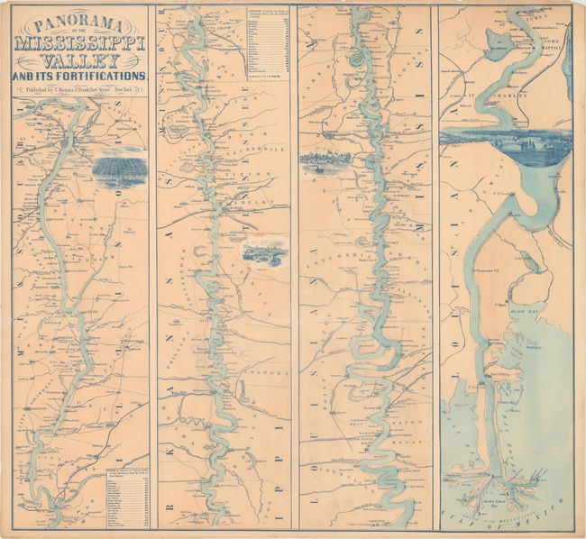
“Panorama of the Mississippi Valley and Its Fortifications”
Map Maker:
Charles Magnus [& Co.]
This great Civil War map is in the strip-map style... (full text available to subscribers)
| Item Detail |
| |
| |
MapMaker: |
Charles Magnus [& Co.]
|
|
| |
| |
Subject: |
South Central United States |
|
| |
Period/Size: |
1863 / 23.5" x 25.2" (59.7 x 64.0 cm)
|
|
| |
Color: |
Colored
|
|
| |
Condition: |
(B+) There are a few small light dampstains at top and a short edge tear at left that has been closed on verso with archival tape. A few tiny edge chips at top just touch the border. (condition help) |
|
| |
Source: |
|
|
| |
References: |
Stephenson (Civil War) (2nd ed.) 42.5. |
|
| |
|
|
| Sales Information |
| |
| |
Price: |
|
|
| |
| |
Offered by: |
Old World Auctions |
|
| |
Catalog: |
Auction No. 163 - Antique Maps, Charts, Atlases & Globes (9365) |
|
| |
Lot/Item #: |
188 |
|
| |
| |
Date: |
06/2017
|
|
| |
| |
|
Antique Maps - Valuation and Pricing, Descriptions, Resources |
|
Home |
Information |
Search |
Register |
Contact Us |
Site Map
Americana Exchange, Inc. © 1999 - 2024 Americana Exchange, Inc.. All rights reserved.
OldMaps.com, the OldMaps.com logo and
AMPR are service marks or registered service marks of Americana Exchange, Inc..
|