| Item Detail |
| |
| |
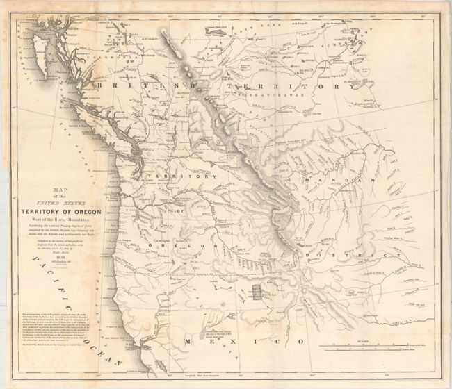
MapMaker: |
Albert/Hood
|
|
| |
| |
Subject: |
Northwestern United States |
|
| |
Period/Size: |
1838 / 17.4" x 20.3" (44.2 x 51.6 cm)
|
|
| |
Color: |
Black & White
|
|
| |
Condition: |
(B+) Issued folding with light scattered foxing. There is a binding trim at left and an associated binding tear that enters 3.5" into the image that has been closed on verso with archival tape. (condition help) |
|
| |
Source: |
HR Doc. 101, 25th Congress, 3rd Session |
|
| |
References: |
Wheat (TMW) #434; Claussen & Friis #221. |
|
| |
|
|
| Sales Information |
| |
| |
Price: |
|
|
| |
| |
Offered by: |
Old World Auctions |
|
| |
Catalog: |
Auction No. 163 - Antique Maps, Charts, Atlases & Globes (9365) |
|
| |
Lot/Item #: |
228 |
|
| |
| |
Date: |
06/2017
|
|
| |
| |
|