Title:
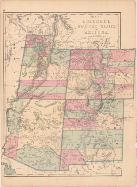
“Map of Colorado, Utah, New Mexico, and Arizona”
Map Maker:
J. David Williams
This uncommon regional map is hand colored to deli... (full text available to subscribers)
| Item Detail |
| |
| |
MapMaker: |
J. David Williams
|
|
| |
| |
Subject: |
Southwestern United States |
|
| |
Period/Size: |
1873 / 14.2" x 13.8" (36.1 x 35.1 cm)
|
|
| |
Color: |
Colored
|
|
| |
Condition: |
(B+) Overall light toning with binding holes along the right sheet edge as issued. (condition help) |
|
| |
Source: |
Peoples’ Pictorial Atlas |
|
| |
References: |
|
|
| |
|
|
| Sales Information |
| |
| |
Price: |
|
|
| |
| |
Offered by: |
Old World Auctions |
|
| |
Catalog: |
Auction No. 163 - Antique Maps, Charts, Atlases & Globes (9365) |
|
| |
Lot/Item #: |
234 |
|
| |
| |
Date: |
06/2017
|
|
| |
| |
|
Antique Maps - Valuation and Pricing, Descriptions, Resources |
|
Home |
Information |
Search |
Register |
Contact Us |
Site Map
Americana Exchange, Inc. © 1999 - 2024 Americana Exchange, Inc.. All rights reserved.
OldMaps.com, the OldMaps.com logo and
AMPR are service marks or registered service marks of Americana Exchange, Inc..
|