Title:
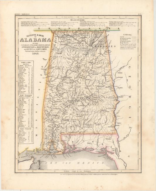
“Neueste Karte von Alabama mit Seinen Canaelen, Strassen, Eisenbahnen, Entfernungen der Hauptpunkte und Routen...”
Map Maker:
Joseph Meyer
This is the German edition of the Tanner/Mitchell ... (full text available to subscribers)
| Item Detail |
| |
| |
MapMaker: |
Joseph Meyer
|
|
| |
| |
Subject: |
Alabama |
|
| |
Period/Size: |
1845 / 14.6" x 11.8" (37.1 x 30.0 cm)
|
|
| |
Color: |
Colored
|
|
| |
Condition: |
(B+) Original outline color with faint dampstaining at right and a few spots of foxing. (condition help) |
|
| |
Source: |
Meyer's Hand Atlas |
|
| |
References: |
|
|
| |
|
|
| Sales Information |
| |
| |
Price: |
|
|
| |
| |
Offered by: |
Old World Auctions |
|
| |
Catalog: |
Auction No. 163 - Antique Maps, Charts, Atlases & Globes (9365) |
|
| |
Lot/Item #: |
240 |
|
| |
| |
Date: |
06/2017
|
|
| |
| |
|
Antique Maps - Valuation and Pricing, Descriptions, Resources |
|
Home |
Information |
Search |
Register |
Contact Us |
Site Map
Americana Exchange, Inc. © 1999 - 2024 Americana Exchange, Inc.. All rights reserved.
OldMaps.com, the OldMaps.com logo and
AMPR are service marks or registered service marks of Americana Exchange, Inc..
|