| Item Detail |
| |
| |
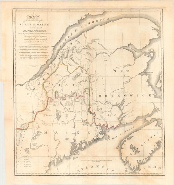
MapMaker: |
S.L. Dashiell
|
|
| |
| |
Subject: |
Maine |
|
| |
Period/Size: |
1830 / 17.3" x 15.7" (44.0 x 39.9 cm)
|
|
| |
Color: |
Colored
|
|
| |
Condition: |
(B) Issued folding and now flattened and backed with tissue. There is light toning and offsetting, and a binding trim at lower left that has been replaced with old paper. (condition help) |
|
| |
Source: |
|
|
| |
References: |
Phillips (Maps) p. 384; cf. Claussen & Friis #220. |
|
| |
|
|
| Sales Information |
| |
| |
Price: |
|
|
| |
| |
Offered by: |
Old World Auctions |
|
| |
Catalog: |
Auction No. 163 - Antique Maps, Charts, Atlases & Globes (9365) |
|
| |
Lot/Item #: |
313 |
|
| |
| |
Date: |
06/2017
|
|
| |
| |
|