Title:
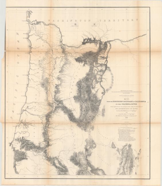
“Map No. 2 from the Northern Boundary of California to the Columbia River from Explorations and Surveys Made Under the Direction of Hon. Jefferson Davis, Sec. of War...”
Map Maker:
Williamson & Abbot
From the surveys of Williamson and Abbot, this map... (full text available to subscribers)
| Item Detail |
| |
| |
MapMaker: |
Williamson & Abbot
|
|
| |
| |
Subject: |
Oregon |
|
| |
Period/Size: |
1855 / 27.3" x 23.2" (69.4 x 59.0 cm)
|
|
| |
Color: |
Black & White
|
|
| |
Condition: |
(B) Issued folding with light toning along the folds and several fold separations along the left side of the image that have been repaired on verso with archival tape. Trimmed to just inside the neatline at top left. (condition help) |
|
| |
Source: |
U.S. Pacific Railroad Surveys |
|
| |
References: |
Wheat (TMW) #882. |
|
| |
|
|
| Sales Information |
| |
| |
Price: |
|
|
| |
| |
Offered by: |
Old World Auctions |
|
| |
Catalog: |
Auction No. 163 - Antique Maps, Charts, Atlases & Globes (9365) |
|
| |
Lot/Item #: |
342 |
|
| |
| |
Date: |
06/2017
|
|
| |
| |
|
Antique Maps - Valuation and Pricing, Descriptions, Resources |
|
Home |
Information |
Search |
Register |
Contact Us |
Site Map
Americana Exchange, Inc. © 1999 - 2024 Americana Exchange, Inc.. All rights reserved.
OldMaps.com, the OldMaps.com logo and
AMPR are service marks or registered service marks of Americana Exchange, Inc..
|