Title:
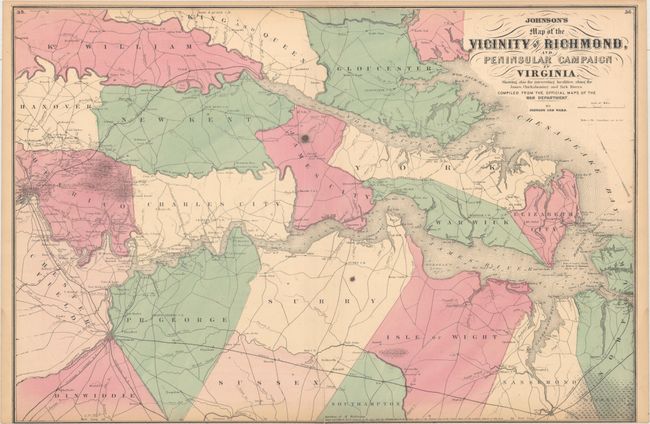
“Johnson's Map of the Vicinity of Richmond, and Peninsular Campaign in Virginia. Showing Also the Interesting Localities Along the James, Chickahominy and York Rivers...”
Map Maker:
Johnson & Ward
A very interesting Civil War map that was c... (full text available to subscribers)
| Item Detail |
| |
| |
MapMaker: |
Johnson & Ward
|
|
| |
| |
Subject: |
Eastern Virginia |
|
| |
Period/Size: |
1862 / 17.8" x 26.5" (45.3 x 67.4 cm)
|
|
| |
Color: |
Colored
|
|
| |
Condition: |
(B) Original color with light toning, two dark spots apparently caused by paper flaws, and several separations along the centerfold that have been closed on verso with archival tape. Trimmed to neatline at bottom, as issued. (condition help) |
|
| |
Source: |
|
|
| |
References: |
|
|
| |
|
|
| Sales Information |
| |
| |
Price: |
|
|
| |
| |
Offered by: |
Old World Auctions |
|
| |
Catalog: |
Auction No. 163 - Antique Maps, Charts, Atlases & Globes (9365) |
|
| |
Lot/Item #: |
374 |
|
| |
| |
Date: |
06/2017
|
|
| |
| |
|
Antique Maps - Valuation and Pricing, Descriptions, Resources |
|
Home |
Information |
Search |
Register |
Contact Us |
Site Map
Americana Exchange, Inc. © 1999 - 2024 Americana Exchange, Inc.. All rights reserved.
OldMaps.com, the OldMaps.com logo and
AMPR are service marks or registered service marks of Americana Exchange, Inc..
|