| Item Detail |
| |
| |
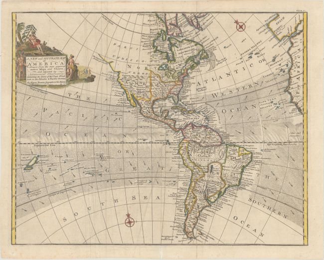
MapMaker: |
Emanuel Bowen
|
|
| |
| |
Subject: |
Western Hemisphere - America |
|
| |
Period/Size: |
1744 / 13.9" x 17.7" (35.3 x 45.0 cm)
|
|
| |
Color: |
Colored
|
|
| |
Condition: |
(B+) Issued folding on paper with fleur-de-lis and "IV" watermarks. There are some extraneous creases that have been pressed flat, one tiny hole along Lake Huron, and an archivally repaired fold separation confined to the bottom blank margin. (condition help) |
|
| |
Source: |
John Harris' Navigantium atque Itinerantium Bibliotheca |
|
| |
References: |
Shirley (BL Atlases) G.HARR-1a #15. |
|
| |
|
|
| Sales Information |
| |
| |
Price: |
|
|
| |
| |
Offered by: |
Old World Auctions |
|
| |
Catalog: |
Auction No. 164 - Antique Maps, Charts, Atlases & Globes (9364) |
|
| |
Lot/Item #: |
56 |
|
| |
| |
Date: |
09/2017
|
|
| |
| |
|