| Item Detail |
| |
| |
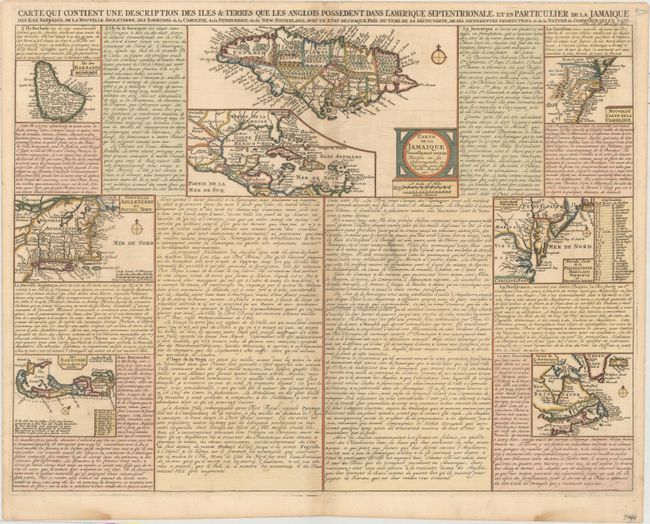
MapMaker: |
Henry Abraham Chatelain
|
|
| |
| |
Subject: |
Colonial Eastern North America, West Indies & Bermuda |
|
| |
Period/Size: |
1719 / 15.4" x 20.4" (39.2 x 51.9 cm)
|
|
| |
Color: |
Colored
|
|
| |
Condition: |
(B+) A crisp impression on paper with a Strasboug bend & lily watermark. There is a bit of printer's ink residue near the center, very light toning along the centerfold, and damp stains along the bottom edge of the sheet, well away from the image. (condition help) |
|
| |
Source: |
Atlas Historique… |
|
| |
References: |
McCorkle #719.3. |
|
| |
|
|
| Sales Information |
| |
| |
Price: |
|
|
| |
| |
Offered by: |
Old World Auctions |
|
| |
Catalog: |
Auction No. 164 - Antique Maps, Charts, Atlases & Globes (9364) |
|
| |
Lot/Item #: |
91 |
|
| |
| |
Date: |
09/2017
|
|
| |
| |
|