| Item Detail |
| |
| |
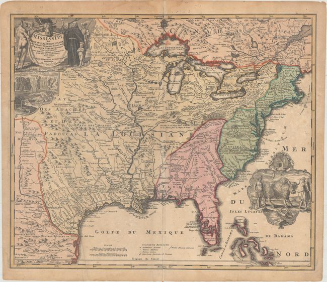
MapMaker: |
Johann Baptist Homann
|
|
| |
| |
Subject: |
Colonial Eastern United States & Canada |
|
| |
Period/Size: |
1720 / 19.3" x 22.8" (49.1 x 58.0 cm)
|
|
| |
Color: |
Colored
|
|
| |
Condition: |
(B) Original color with light toning, minor scattered foxing, an archivally repaired centerfold separation that enters 1.75" into the image at bottom, and a long extraneous crease at left. (condition help) |
|
| |
Source: |
|
|
| |
References: |
McCorkle #720.1; Goss (NA) #49; cf. Wheat (TMW) #144; cf. Cumming (SE) #170. |
|
| |
|
|
| Sales Information |
| |
| |
Price: |
|
|
| |
| |
Offered by: |
Old World Auctions |
|
| |
Catalog: |
Auction No. 164 - Antique Maps, Charts, Atlases & Globes (9364) |
|
| |
Lot/Item #: |
107 |
|
| |
| |
Date: |
09/2017
|
|
| |
| |
|