| Item Detail |
| |
| |
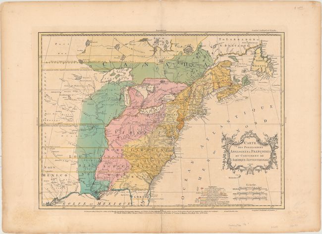
MapMaker: |
Jean Palairet
|
|
| |
| |
Subject: |
Colonial Eastern United States & Canada |
|
| |
Period/Size: |
1755 / 16.4" x 22.7" (41.7 x 57.7 cm)
|
|
| |
Color: |
Colored
|
|
| |
Condition: |
(B+) Full original color on paper with a large fleur-de-lis watermark and wide margins. There is light soiling, minor toning, and an archivally repaired centerfold separation that just enters the map border at bottom. (condition help) |
|
| |
Source: |
Atlas Methodique... |
|
| |
References: |
McCorkle #755.22; Sellers and Van Ee #56; Shirley (BL Atlases) T.PAL-1a #14; Tooley (America), p. 62 |
|
| |
|
|
| Sales Information |
| |
| |
Price: |
|
|
| |
| |
Offered by: |
Old World Auctions |
|
| |
Catalog: |
Auction No. 164 - Antique Maps, Charts, Atlases & Globes (9364) |
|
| |
Lot/Item #: |
108 |
|
| |
| |
Date: |
09/2017
|
|
| |
| |
|